![]()
![]()
![]()
![]()
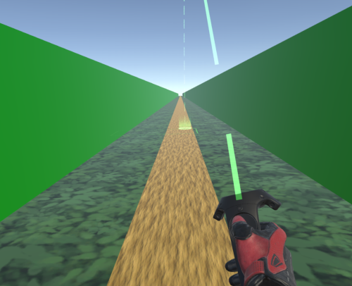
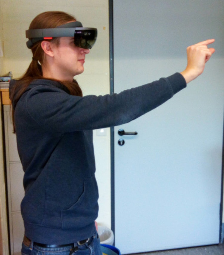
Aufgrund der fortschreitenden technischen Entwicklung und sinkenden Hardwarepreisen wurden Virtual Reality (VR) und Augmented Reality (AR) Head-Mounted Displays (HMDs) in den letzten Jahren immer beliebter und beginnen Sich als Konsumprodukte zu etablieren. Für die Kartographie ergeben sich hierdurch neue Möglichkeiten für die Repräsentation des Raumes mittels immersiver und interaktiver 3D Modelle, sowie Fragen zur Wahrnehmung virtueller und erweiterter (augmented) Umgebungen. In experimentellen Studien untersuchen wir Gemeinsamkeiten und Unterschiede bei der Wahrnehmung realer, virtueller und erweiterter Umgebungen, sowie Potenziale von VR- und AR-Technik für die effektive und effiziente Vermittlung räumlicher Informationen. Des weiteren entwickeln wir Workflows für die Entwicklung virtueller räumlicher Modelle basierend auf verfügbaren Geodaten.
Keil, J., Korte, A., Edler, D., O‘Meara, D., & Dickmann, F. (2021). Changes of Locomotion Speed Affect Distance Estimations in Virtual Reality. Proceedings of the ICA, 4, 1–5. https://doi.org/10.5194/ica-proc-4-57-2021
Dickmann, F., Keil, J., Dickmann, P. L., & Edler, D. (2021). The Impact of Augmented Reality Techniques on Cartographic Visualization. KN - Journal of Cartography and Geographic Information, 71(4), 285–295. https://doi.org/10.1007/s42489-021-00091-2
Keil, J., Edler, E., O’Meara, D., Korte, A., & Dickmann, F. (2021). Effects of Virtual Reality Locomotion Techniques on Distance Estimations. International Journal of Geo-Information, 10(3), 1-17. https://doi.org/10.3390/ijgi10030150
Keil, J., Edler, D., Schmitt, T., & Dickmann, F. (2021). Creating Immersive Virtual Environments Based on Open Geospatial Data and Game Engines. KN - Journal of Cartography and Geographic Information. https://doi.org/10.1007/s42489-020-00069-6
Edler, D., Keil, J., & Dickmann, F. (2020). From na pali to earth—an ‘unreal’engine for modern geodata?. In Modern approaches to the visualization of landscapes (pp. 279-291). Springer VS, Wiesbaden. https://doi.org/10.1007/978-3-658-30956-5_15
Keil, J., Korte, A., Ratmer, A., Edler, D., & Dickmann, F. (2020). Augmented Reality (AR) and spatial cognition: effects of holographic grids on distance estimation and location memory in a 3D indoor scenario. Journal of Photogrammetry, Remote Sensing and Geoinformation Science, 88(2), 165–172. https://doi.org/10.1007/s41064-020-00104-1
Edler, D., Keil, J., Wiedenlübbert, T., Sossna, M., Kühne, O., & Dickmann, F. (2019). Immersive VR experience of redeveloped post-industrial sites: the example of “Zeche Holland” in Bochum-Wattenscheid. KN - Journal of Cartography and Geographic Information, 69(4), 267–284. https://doi.org/10.1007/s42489-019-00030-2
Keil, J., Edler, D., & Dickmann, F. (2019). Preparing the HoloLens for user studies: an augmented reality interface for the spatial adjustment of holographic objects in 3D indoor environments. KN - Journal of Cartography and Geographic Information, 69(3), 205–215. https://doi.org/10.1007/s42489-019-00025-z
Edler, D., Husar, A., Keil, J., Vetter, M., & Dickmann, F. (2018). Virtual Reality (VR) und Open Source Software: ein Workflow zur Konstruktion einer interaktiven kartographischen VR-Umgebung zur Erkundung urbaner Landschaften. Kartographische Nachrichten, 68(1), 3–11.
Edler, D., Kühne, O., Jenal, C., Vetter, M., & Dickmann, F. (2018). Potenziale der Raumvisualisierung in Virtual Reality (VR) für die sozialkonstruktivistische Landschaftsforschung. Kartographische Nachrichten, 68(5), 245–254. https://doi.org/10.1007/BF03545421
Copyright © 2022
Letzte Änderung: 11. Mai. 2022

